
 Tweet
Tweet
I just got myself a used DJI Mavic M1P drone. In mint condition.
I'm a total newbie at this stuff. A few years ago I had some cheap toy drone, it cost 70-80e then, it had no camera and none of the advanced options. It was a total disappointment.
After I broke all the glass around the house with it... I gave up and sold it. However, technology has advanced, today all this is a different story.
The Mavic "drives itself"... it has stabilization, a very good camera, and is quite automated and stable.
The idea is to practice handling well first and get used to it. And then to try to add whatever I need to it so that I can map sites and terrains with it.
I live in a hilly and wooded area, things are much better seen from a height. I thought of combining this technology with our hobby.
Does anyone have specific experiences?


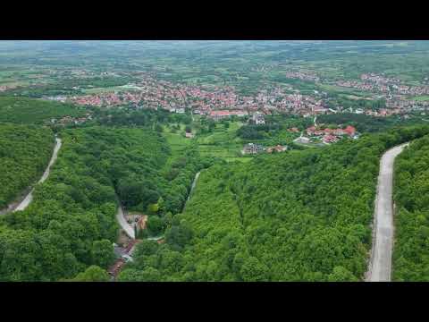
 I would definitely take a walk to the hills in the distance (2 min and 3 sec. of the video). The most useful processing of video information is viewing from a great distance and smoothly transitioning to a close-up view. For beginner operators in Bulgaria there is a limit of 120m of drone flying height, how is it in Serbia?

Comment